North & South Crocker Mountain
Appalachian Trail Conservancy
799 West Washington Street
Harpers Ferry, WV 25425
(304) 535-6331

The Appalachian Trail in Maine is generally considered the most difficult of all the fourteen states that the A.T. traverses. In some sections, don’t expect to hike more than a mile an hour and get used to steep ascents and descents. Slippery and sometimes hazardous weather can occur at any time, and the terrain is often remote to say the least.
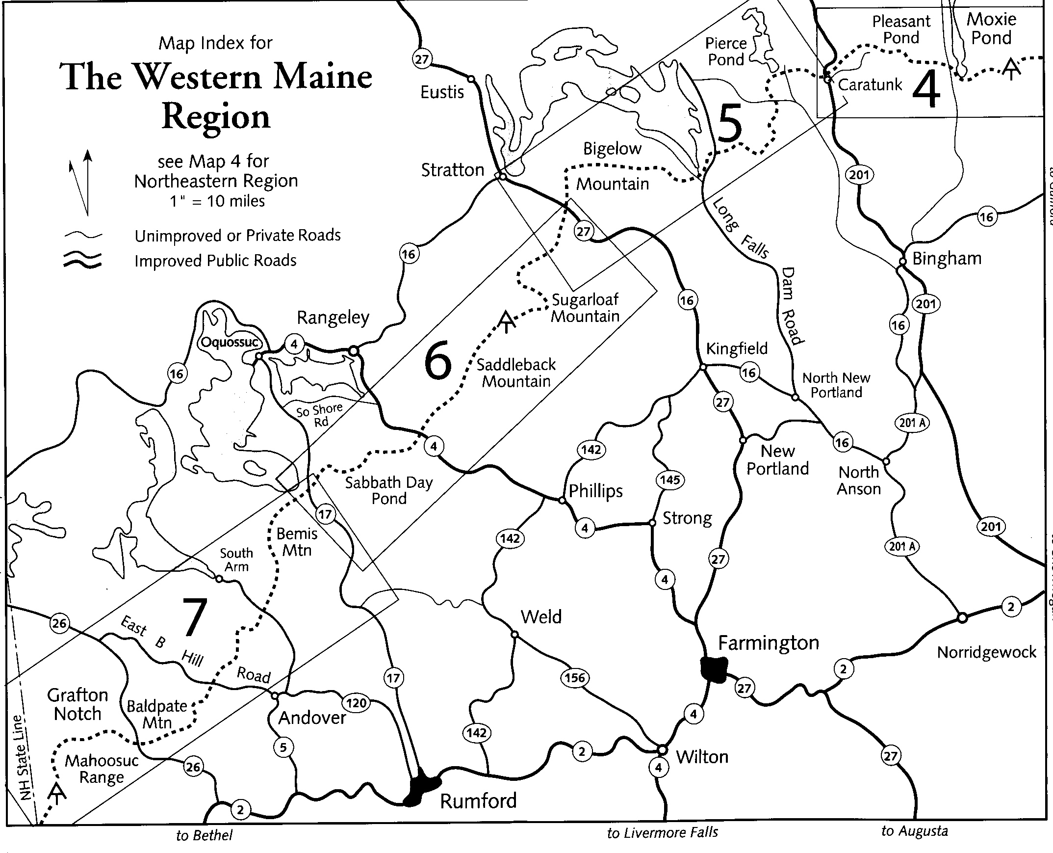
This hike over the Crocker Mountains follows the Appalachian Trail for 8.1 miles near Stratton, Maine. It can be done from either the ME 27 or Caribou Valley Road trailheads but plenty of effort is required to summit regardless of the direction. The Crocker Cirque Campsite is located about a mile from Caribou Valley Road, and is the best campsite in this area. It is situated in a glacial bowl near a small pond with tent platforms, a spring, and a privy. From the pond, there are views toward the Crocker Mountains and the A.T. with peaks that sit over 1300 feet above the site. It’s a very scenic campsite, but don’t underestimate the difficulty of the terrain in this area.
- click to view a video slideshow from our hike across the Crocker Mountains (w/ live video), w/o live video: September 30, 2012
- click to see the video No Rain, No Pain, No Maine, Crocker Cirque Campsite
- click for Soggy Bottom Boys, The White Wolf Inn videos
- click to hear a podcast about this hiking trip near Sugarloaf Ski Resort: part one, part two
- click to see trail photos from this hike on the Appalachian Trail in Maine: September 30, 2012
- click to view a trip report for this hike near Stratton, Maine: September 30, 2012 (password required)
- click to view an area map, detailed map, profile map (password required)
- lick to view an Appalachian Trail map from this section from ME 27 to ME 17 (password required)
- click for more information on the Appalachian Trail
- click for Appalachian Trail hiking and backpacking books
- click to access the guidebook Appalachian Trail: Maine which has details on this destination
- click for other Maine hiking and backpacking books