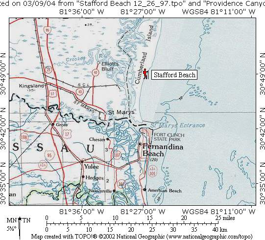
Stafford Beach
Cumberland Island National Seashore
101 Wheeler Street
Saint Marys, 31558
Visitor Information
912-882-4336 x254

The Cumberland Island National Seashore and Wilderness Area is composed of 8,840 acres of primitive, undeveloped land. The southern boundary is located four and one-half miles north of Sea Camp, and within the wilderness are three camping areas or “zone camps” where individual sites are not designated. Campers may setup their tents anywhere they choose within 50 yards of the camp sign.
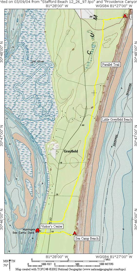
Most visitors to Cumberland Island arrive by ferry from the waterfront docks at the Cumberland Island National Seashore Visitor Center located in St. Marys, Georgia. Backcountry camping reservations are issued at Sea Camp Visitor Center on the island, and there are five campsites including Sea Camp, which is a walk-in site a short distance from the ferry landing. On our hike, we backpacked in to the Stafford Beach campsite but another option is to stay at Sea Camp and day-hike the seven mile route to Stafford Beach and back. Both sites have easy access to water. Stafford Beach has a hand water pump that draws from an underground well, but Sea Camp has running water at the Sea Camp Visitor’s Center with a water fountain nearby.
- click to see trail photos from this hike on Cumberland Island: December 26, 1997
- click to view a detailed trip report of this hike at the Cumberland Island National Seashore: December 26, 1997 (password required)
- click for a Daytimer report of this coastal backpacking trip near St. Mary’s Georgia (password required)
- click for a park map of the Cumberland Island National Seashore
- click for a topographic and profile map of this backpacking trip to Stafford Beach
- click to see where Stafford Beach is located on Cumberland Island
- click for the guidebook Hiking Trails North Georgia for more hikes in this area
- click for more hiking and backpacking books from Georgia


